Events Calendar

Three hours around Mt Rogers and surrounding suburbs using MapRunF App. A very big thank you to our course setter Jon Glanville for his work in setting the course and setting it up in the MapRunF App.
Results
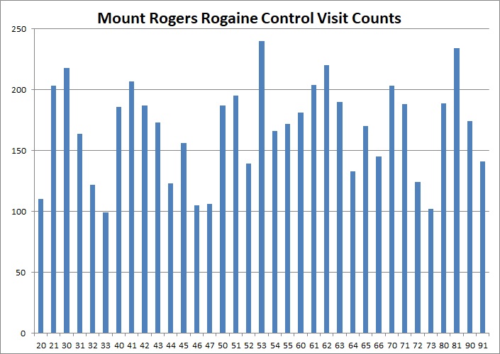
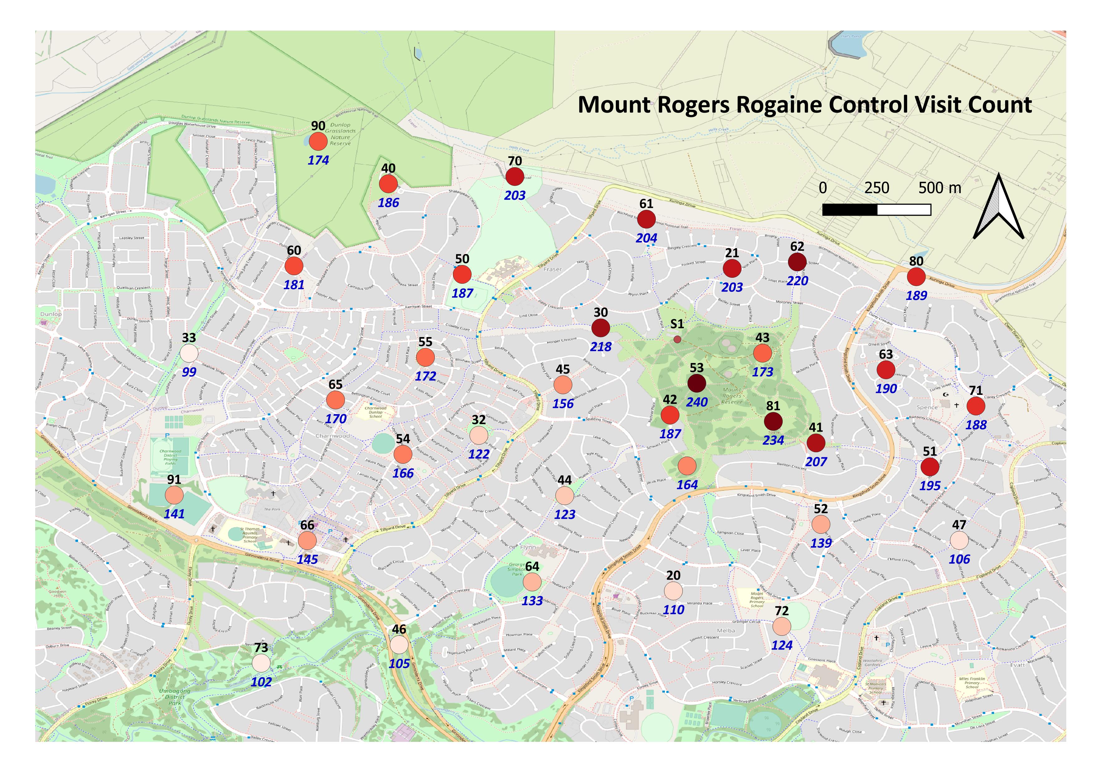
The results of the Mt Rogers Rogaine by overall and by category are available to download here. Congratulations to Tomas Krajca who was the fastest person around all the controls in 1:34:36.
There are some teams who entered but we have not seen an uploaded MapRunF result. If you have a zero score but did the event, email Julie and we will include you in the results.
See the photo gallery and facebook page for photos of the event. If you have others you want to share, drop Julie an email.
Instructions
The course will open at 6 am on Saturday 30 May and close at 6 pm on Monday 8 June. You can participate any time when the course is open. Your team can take up to 3 hours to do the course. Rogaining scoring applies - controls score points according to 10s (e.g. 54 scores 50 points) but with 30 points per minute late after 3 hours as penalty.
Either download and print a map or you can pick a free teslin one from Paddy Pallin in Lonsdale Street, Braddon. See the box on the table of books near the door. Please use the hand sanitiser before touching the maps.
Please read the course setters notes. These are printed on the back of the teslin maps, or you can print a copy yourself.
At least one person in each team will need to download the MapRunF (make sure you get the "F" version) App. Either seach on your app store or go to the website that will direct you to the right App. Please download and read these instructions on using MapRunF to learn how to use the App. The App uses the GPS on your phone to work out you are at the control location. To score a control you will need to be within 10 m of the feature. Check your detailed control descriptions as there will be no flags.
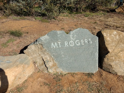
The start is at the engraved Mt Rogers sign on the rock at the end of Wickens Place, Fraser, next to the carpark.
A reminder that you participate in this event at your own risk and are responsible for your own safety. The course is designed to maximise use of footpaths and underpasses but you may need to cross some busy roads. Please take care. You should also observe appropriate social distancing if you encounter other teams or people.
If you have specific questions, please contact the coordinator Julie Quinn by email or phone 0421 021 693.
Entry is free but if you enter we can upload and create results in the traditional format after the finish. Results are available as teams upload them from the MapRunF App after they finish. See who you are competing against by viewing the team list at the link below. Feel free to do it again and again. Introduce someone new to rogaining. See if you can go further with a different friend. Depending on your route choice and navigation, it will be around 22-25km to visit all the controls. Faster teams might like to try getting around them all.
If you take photos, we can include them in with the setters and vetters photos in the ACTRA image gallery. Put them on a file sharing service (e.g. Google Drive, Dropbox) and email Julie a link.
You can also use your MapRunF App by going around one of the virtual orienteering maps available in Canberra. Aranda, Florey, Red Hill, Garren, Monash, Weetangara Street-O events so far.
| Contact | Julie Quinn
|
| Coordinator | Julie Quinn |
| Setters and Vetters | Setter: Jon GlanvilleVetters: Julie Quinn, David BaldwinMap maker: Jon Glanville |
| First Aid | Not Needed |
| Control Collection | Not Needed |
| General Help | Not Needed |
| Catering | None |